Tropical wave reaches 70% development odds in the Atlantic: what Puerto Rico should watch this week
CoquiList · With information from National Hurricane Center
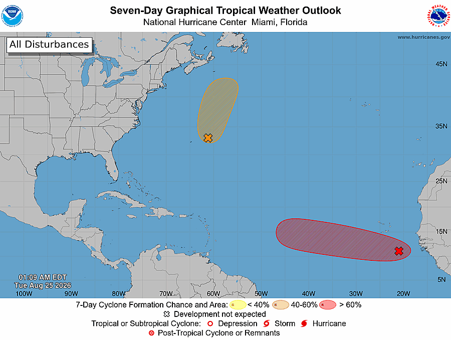
The Atlantic woke up just as hurricane season enters its peak weeks. The National Hurricane Center (NHC) on Tuesday raised to 70% the probability that a tropical wave near Cabo Verde becomes a cyclone within the next seven days, and to 60% within the next 48 hours 1. There is no immediate threat to Puerto Rico, but the experts' message is clear: if the system survives the Saharan dust and hostile shear, the northeastern Caribbean islands and Bermuda would be among the first areas that need to pay attention 3.
In its 2:00 a.m. bulletin this Tuesday, August 25, the NHC placed the system, designated AL96, a few hundred miles south-southeast of the Cabo Verde Islands, moving westward to west-northwestward across the eastern and central tropical Atlantic 1. That is the classic route of so-called Cabo Verde cyclones, historically the ones that have hit Puerto Rico hardest. The NHC is also watching a second system, AL95, a couple of hundred miles east-northeast of Bermuda, with a 40% chance of development, but that one is moving north at 15 to 20 mph and poses no risk to the island 1.
The 2026 season has run slow so far: only three named storms (Arthur, Bertha and Cristobal) and no hurricanes, partly because of an El Niño that NOAA says could reach historic strength this year and because of Saharan dust layers that have smothered developing systems 3. The next name on the list is Dolly. Even so, hurricane specialist Bryan Norcross warned that many of the computer simulations that show the system surviving its encounter with the dust and hostile upper winds turn it into a hurricane as it heads north of the Caribbean, a scenario that would not play out until next week 3.
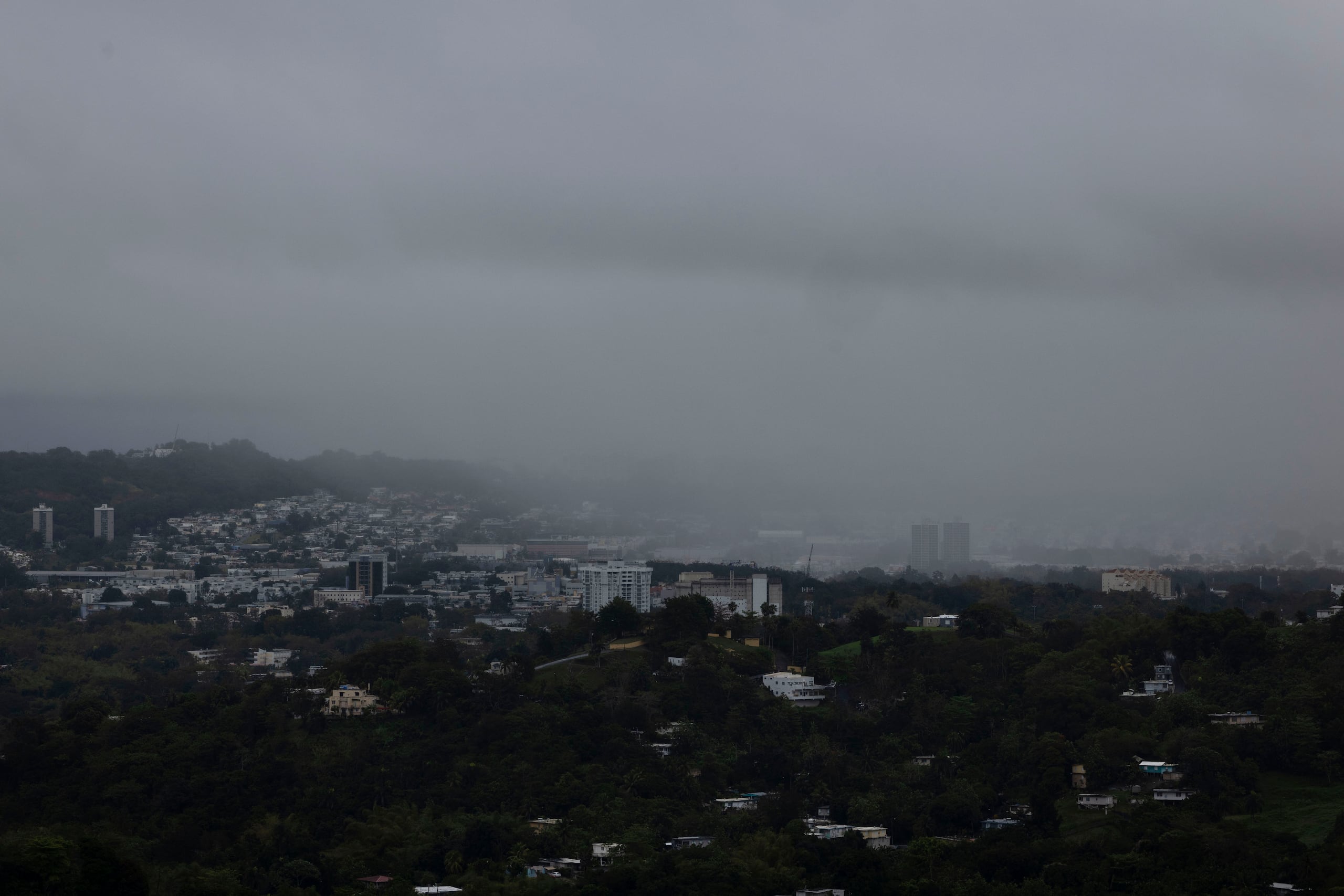
Meanwhile, local weather is running its own agenda. The National Weather Service (NWS) in San Juan said in its 3:16 a.m. discussion that a weak tropical wave crosses the region today, with showers first over eastern Puerto Rico and the Virgin Islands and afternoon thunderstorms over the interior, west and north 2. Saharan dust peaks Wednesday with reduced visibility, and a second wave carrying deeper moisture arrives between Friday night and the weekend: Saturday is the day with the greatest potential for rain and flooding 2. Rip current risk climbs to moderate from Wednesday night on north- and east-facing beaches 2.
The heat is not letting up either. Monday brought a heat advisory for 43 municipalities between 10:00 a.m. and 4:00 p.m., with heat indices up to 107°F and a forecast of 109°F for today 4. And although the weekend wave will bring water, the projected rainfall looks insufficient to substantially improve the drought that keeps the island under water rationing 4.
What it means for you
Nobody is saying a hurricane is coming to Puerto Rico. What is happening is that the Atlantic pattern switched on right before the climatological peak of the season, September 10, and this time with a system on the Cabo Verde route 13. Preparing now, calmly and without lines at the store, is always cheaper than doing it with a forecast cone overhead. There is an extra wrinkle this year: with water rationing in effect, filling your emergency reserves requires planning around the service cycles. And watch out Saturday: after weeks of dry, burned terrain, a heavy downpour runs off faster than it soaks in, so the urban flooding risk is real 2.
How to do it / Checklist
- Check the NHC outlook at nhc.noaa.gov; it updates at 2:00 a.m., 8:00 a.m., 2:00 p.m. and 8:00 p.m. 1.
- Follow NWS San Juan at weather.gov/sju for day-by-day local effects 2.
- Verify your basic inventory: bottled water (one gallon per person per day, minimum 10 days), non-perishable food, batteries, flashlight, radio and a power bank.
- If your zone gets its water service cycle this week, use it to fill your reserve containers ahead of time.
- Clean drains, gutters and roofs before Friday, with Saturday's rain in mind 2.
- Keep two weeks of medications on hand, important documents in a sealed bag, and some cash.
- Save the key numbers: Emergency Management (NMEAD) 787-724-0124 and AAA customer service 787-620-2482.
What's next
The NHC could declare a tropical depression in the coming days if AL96 keeps organizing; its 48-hour probability already sits at 60% 1. Current models favor a turn north of the Caribbean next week, but at seven days out that scenario can change, and the northeastern Caribbean will stay on the watch list 3. Locally, Saharan dust dominates Wednesday, the Friday-to-Sunday wave decides whether it truly rains, and Saturday carries the highest flood risk 2. CoquiList will follow the system bulletin by bulletin.
Sources
- National Hurricane Center — Tropical Weather Outlook: https://www.nhc.noaa.gov/text/MIATWOAT.shtml
- NWS San Juan — Area Forecast Discussion: https://forecast.weather.gov/product.php?site=NWS&issuedby=SJU&product=AFD&format=CI&version=1&glossary=0
- Fox Weather — Watching for next tropical system in the Atlantic: https://www.foxweather.com/weather-news/atlantic-next-tropical-system-august-2026
- Noticel — Continúa el patrón seco para la isla y también una advertencia de calor: https://noticel.com/noticias/20260824/continua-el-patron-seco-para-la-isla-y-tambien-una-advertencia-de-calor/
CoquiList summary and local context. Read the linked sources for the original reporting.
Ask about this story
Ask anything about this article — in English or Spanish.
Log in to ask about this story.
Comments (0)
Log in to join the conversation.
No comments yet — be the first.