Two Tropical Waves Trigger Flood Advisories and Dangerous Heat in Puerto Rico
CoquiList · With information from El Nuevo Día
Puerto Rico woke up this Thursday, September 10, under the effect of two tropical waves that triggered flood advisories for seven municipalities overnight and that today bring showers, thunderstorms, dangerous heat and rough surf to much of the island 12.
The first wave crossed the region on Wednesday and dropped intense rain over the north and central parts of the island. Shortly after midnight, the National Weather Service in San Juan (NWS San Juan) issued a flood advisory for Arecibo, Barceloneta, Florida, Manati and Vega Baja, in effect until 1:30 a.m., after Doppler radar detected between 0.5 and two inches of rain from thunderstorms 4. Minutes later the agency issued a second advisory for Barranquitas and Orocovis, in effect until 2:15 a.m., with between one and two additional inches in those mountain towns 4. Both advisories warned of minor flooding in low-lying, poor-drainage areas, water over roadways, and rises in creeks and normally dry streams 4.
That rain was just the preamble. According to NWS San Juan meteorologist Mariangelis Marrero, the week's greatest rain potential arrives between Wednesday night and Thursday morning, when residual moisture from the first wave combines with the arrival of the second: "It is basically the residual humidity from this first one passing through today, combining with the arrival of the other wave," she explained 1.
This week's numbers
- Flood advisories issued between 12:07 a.m. and 1:44 a.m. Thursday for seven municipalities, with accumulations of up to two inches per sector 4.
- A 60% chance of rain today, with general accumulations of a quarter to half an inch across the island, though heavier bands are expected near El Yunque and the east 31.
- Showers beginning in the morning over the east and shifting in the afternoon toward the interior, west and northwest 23.
- Temperatures near 92 degrees Fahrenheit along the coast, with a heat index up to 109 degrees; interior highs run between 80 and 95 32.
- Swells of four to five feet near shore and six to seven feet offshore, with a moderate risk of dangerous rip currents at north, east and southeast beaches plus Culebra and Vieques, spreading to nearly the whole coast as winds strengthen 31.
- Moderate to high Saharan dust starting today, which will somewhat limit rainfall, worsen air quality, and arrive alongside moderate to strong east-southeast winds 21.
What this means for you
If you live in Arecibo, Barceloneta, Florida, Manati, Vega Baja, Barranquitas or Orocovis, the ground is already saturated after the overnight advisories, so any additional rain today can flood roads and low-lying areas faster than usual 4. If you live near El Yunque, the east coast or the mountainous interior, today is the day with the highest risk of heavy downpours and sudden creek rises 13. If you are headed to the beach, the rip current risk is real along nearly the whole coastline, not just the usual danger spots 3. And if you work outdoors, a heat index of up to 109 degrees is just as dangerous as the rain itself 32.
How to prepare: Checklist
- Check the forecast and active advisories at weather.gov/sju before heading out, especially if you live in one of the seven municipalities under advisory overnight 4.
- Never cross a flooded road, on foot or by car: six inches of moving water can sweep a small car off the road 4.
- If you live near a creek or river in Barranquitas, Orocovis, Manati or Vega Baja, move to higher ground as soon as water starts rising, do not wait until it reaches minor flood stage 4.
- Clear gutters and storm drains before the next rain band arrives this afternoon 2.
- If you go to the beach, swim only where lifeguards are present and check the flag color first, given the moderate rip current risk along most of the coast 3.
- Drink water every hour if you work outside and seek shade between noon and 4 p.m., when the heat index peaks 32.
- If you have asthma or another respiratory condition, limit outdoor exercise on Friday, when Saharan dust levels rise 21.
- Charge your phone and keep a flashlight handy: strong thunderstorms can cause isolated power outages 3.
What's next
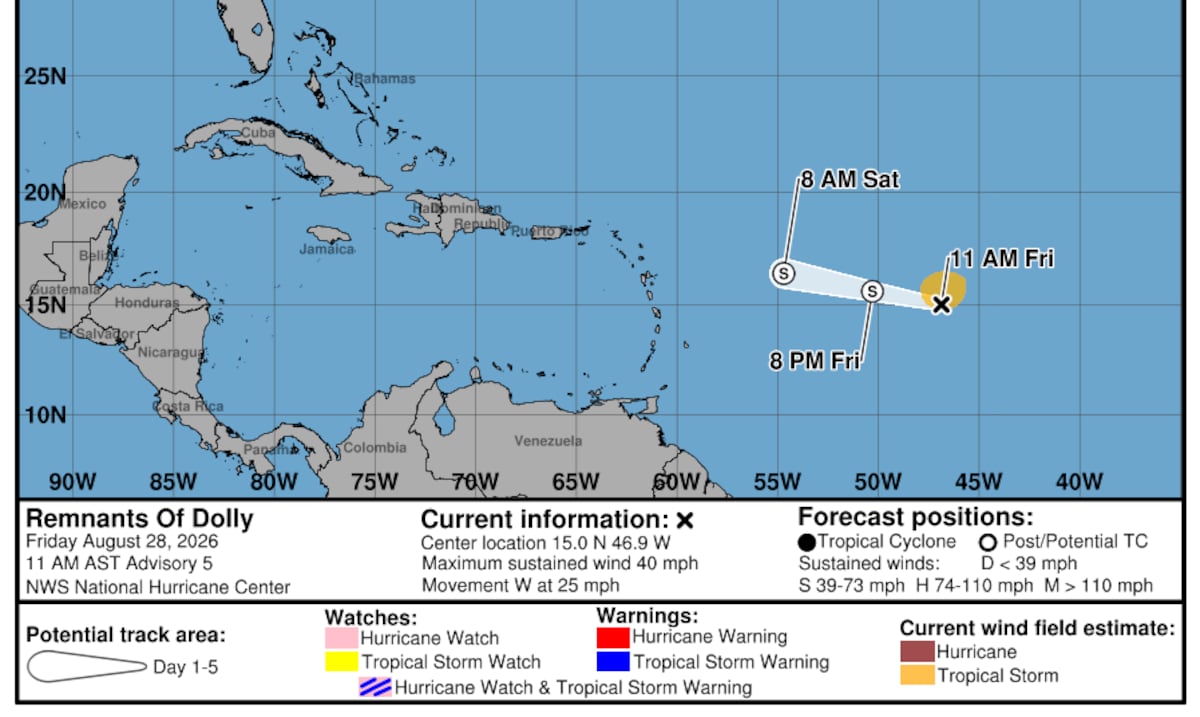
By Friday, the second tropical wave moves away and drier air moves in, so showers taper to isolated activity in the morning over the east and in the afternoon over the interior and northwest 2. According to Marrero, a much bigger rain event than this week's would be needed for meaningful drought relief across the south and east, which are still affected; this week's rain helps, but it is temporary, not a solution 1. With hurricane season still active, NWS San Juan recommends checking advisories daily, since the pattern of tropical waves crossing the Caribbean will continue in the coming weeks 24.
Sources
1 El Nuevo Día — "Dos ondas tropicales se acercan a Puerto Rico: ¿cuándo será el mayor potencial de lluvia?" — https://www.elnuevodia.com/noticias/el-tiempo/notas/dos-ondas-tropicales-se-acercan-a-puerto-rico-cuando-sera-el-mayor-potencial-de-lluvia/ 2 Primera Hora — "Onda tropical traerá aguaceros y tronadas a Puerto Rico este jueves: mira cuáles serían las zonas más afectadas" — https://www.primerahora.com/noticias/el-tiempo/notas/onda-tropical-traera-aguaceros-y-tronadas-a-puerto-rico-este-jueves-mira-cuales-serian-las-zonas-mas-afectadas/ 3 Metro Puerto Rico — "Más lluvia y tronadas por el paso de dos ondas tropicales" — https://www.metro.pr/noticias/2026/09/09/mas-lluvia-y-tronadas-por-el-paso-de-dos-ondas-tropicales 4 National Weather Service San Juan (NWS San Juan) — https://www.weather.gov/sju/
CoquiList summary and local context. Read the linked sources for the original reporting.
Ask about this story
Ask anything about this article — in English or Spanish.
Log in to ask about this story.
Comments (0)
Log in to join the conversation.
No comments yet — be the first.